Description
Property Name: Al Der’ District in Dumat Al-Jandal
Inventory No: –
Date of infill of the inventory form: 2020
Country (State party): Saudi Arabia
Province: Al Jawf
Town: Dumat Al-Jandal
Geographic coordinates: 29°48’40.27″N 39°52’1.39″E
Historic Period: Pre- Islamic Era
Year of Construction: Unknown
Style: –
Original Use: Settlement
Current Use: Archaeological Site
Architect: Unknown
Significance
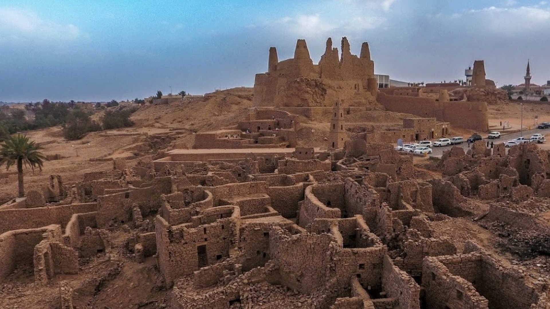
The ruins of a neighborhood in the center of Dumat Al-Jandal within the archaeological area next to the Omar Ibn Al-Khattab Mosque, its area of about 30 thousand square meters, its houses are stone contiguous, and its alleys are connected to each other, and some of them are covered with arches, and these alleys were paved with stones in 1413 AH. Some houses consist of two floors and are similarly roofed with palm fronds. Movement inside the site is dangerous because most of the houses are ramshackle.
Selection Criteria
i. to represent a masterpiece of human creative genius
ii. to exhibit an important interchange of human values, over a span of time or within a cultural area of the world, on developments in architecture or technology, monumental arts, town-planning or landscape design
iii. to bear a unique or at least exceptional testimony to a cultural tradition or to a civilization which is living or which has disappeared
vi. to be directly or tangibly associated with events or living traditions, with ideas, or with beliefs, with artistic and literary works of outstanding universal significance
State of Preservation
Archaeological Site
References
Commission of Tourism and Heritage


